The Suwannee River Water Management District (SRWMD) is working on a flood risk project in partnership with FEMA that includes Union County. The project began in February 2021, and the study contractor has created draft maps showing changes to the Flood Insurance Rate Map (FIRM). The proposed changes could affect some residents, potentially moving them into or out of flood zones, which could have an impact on insurance rates.
• Use this map link to view proposed flood zone changes to your property.
• The map includes the ability to provide comments and feedback.
Suwannee River WMD Virtual Tour Click here for a SRWMD Virtual Tour • View the "Santa Fe Watershed Flood Risk Review Meeting" for more information.
Proposed Flood Zone GIS Map tutorial
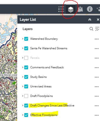
Layer panel • Click the LAYER icon to turn on/off layers
• Check the "Draft Changes Since Last Effective" to view the proposed changes.
• Check the "Effective Floodplains" layer to view the current Flood Zones.
Search for your Property • Enter your Street Address to locate your property.
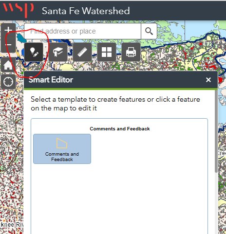
Comments and Feedback • Click the Smart Editor button located under the address search bar.
• Then click "Comments and Feedback" in the Smart Editor window.
• Next draw an area on the map that you wish to comment on or dispute.
• Double click the map to finish drawing the area.
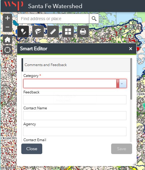
Feedback Form • Fill out the Comments and Feedback form and click Save.
DISCLAIMER
The information presented on this website was derived from data which was compiled by the Union County Property Appraiser solely for the governmental purpose of property assessment. This information should not be relied upon by anyone as a determination of the ownership of property or market value. The GIS Map image is not a survey and shall not be used in a Title Search or any official capacity. No warranties, expressed or implied, are provided for the accuracy of the data herein, its use, or its interpretation. This website was last updated: 4/18/2024 and may not reflect the data currently on file at our office.